Skip to main content
Út um allt ... höfuðborgarsvæðið
en
is
Enter a search string
(-)
Walk
Outdoor Area
Bike
Municipality
Reykjavík
Mosfellsbær
Kópavogur
(-)
Garðabær
Hafnarfjörður
Seltjarnarnes
Path Surface
Other
Gravel
Asphalt
Grass
Facet Path Surface
Duration
2 - 3 hours
30 - 60 minutes
1 - 2 hours
Facet Duration
Difficulty
Level 1
Level 2
Facet Difficulty
Area Access
Facet Area Access
Area services
Facet Area services
Area Type
Facet Area Type
Home
Bike and Hiking Routes
Map of Bike and Hiking Routes
Outdoor Areas
Map of Outdoor Areas
About the Website
How do I use the Website?
Visit Reykjavík
Image
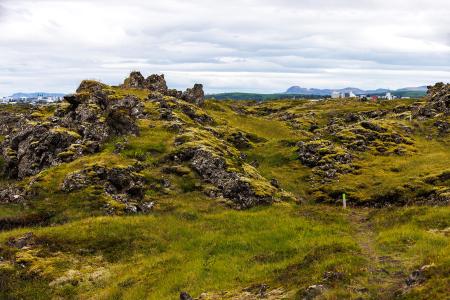
Fógetastígur in Gálgahraun
Walk:
4.17km
Difficulty
Level 1
A stunning walk around the Gálgahraun lava field, where geological formations, birdlife, and…
Garðabær
Image
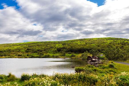
Around Bessastaðatjörn
Walk:
6.50km
Difficulty
Level 1
A walking route around Bessastaðatjörn in a historically rich setting. Along the way, you can…
Garðabær
Image
Urriðavatn
Walk:
3.21km
Difficulty
Level 1
A short and easy walking route around Urriðavatn in Garðabær. The surroundings of the lake are…
Garðabær
Image
The Garðabær Circle
Walk:
7.08km
Difficulty
Level 2
This route starts at Vídalínskirkja, passing through historical sites such as Hofsstaðir and…
Garðabær
Image
Gunnhildur and Vífilstaðarhlíð
Walk:
6.20km
Difficulty
Level 2
A hike in Heiðmörk which takes you up to the cairn Gunnhildur and follows Vífilsstaðahlíð on…
Garðabær
Image
Vífilsstaðavatn
Walk:
2.62km
Difficulty
Level 1
A short and enjoyable walking trail around Vífilsstaðavatn, perfect for anyone looking to…
Garðabær
Image
The Sun Circle in Heiðmörk
Walk:
5.69km
Difficulty
Level 2
The Sun Circle is a hiking route near Vífilsstaðavatn, located in the scenic Heiðmörk area.
Garðabær