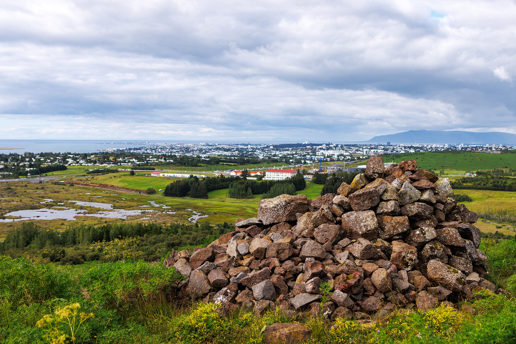
Gunnhildur and Vífilstaðarhlíð
A popular 6 km walking, jogging, and cycling route which starts at the parking lot by Vífilsstaðavatn. The trail follows a well-defined path up Vífilsstaðahlíð, leading to a stone cairn called Gunnhildur. This well-trodden route is surrounded by vast stretches of lupine fields. From the cairn, there is an excellent view of the capital area, making it an ideal spot to take a short break and enjoy the scenery. The route continues along the trail until reaching a viewing platform. From there, the path veers right and goes through a wooded area until it connects with a service road, which leads downhill. At the bottom of the slope, a right turn is taken, following the path along Vífilsstaðahlíð all the way back to the parking lot at Vífilsstaðavatn.
Parking lot by Vífilsstaðavatn
Detailed Information
Duration
Distance
Difficulty
Cumulative Elevation Gain
Maximum Altitude
Available
Access
Path Visibility
Path Lighting
Path Surface
Path Width
Path Dangers
Path Obstacles
Services
Gpx Start Point
Gpx Starting Point Elevation
Cumulative Elevation Loss
Maximum Altitude Coordination
Minimum Altitude
Minimum Altitude Coordinations
Route Distance