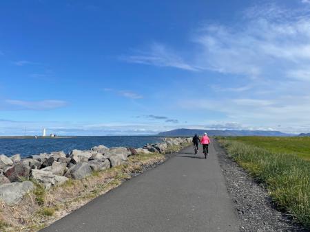
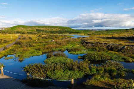
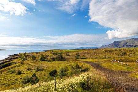
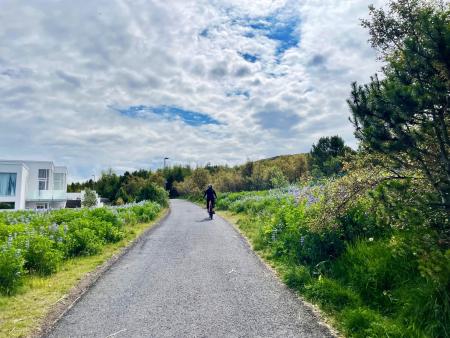
Bike and Hiking Routes Map of Bike and Hiking Routes Map of Outdoor Areas Sveitarfélag Hafnarfjörður Garðabær Kópavogur Reykjavík Seltjarnarnes Mosfellsbær Kjós Yfirborð Asphalt Timber Concrete Rock Gravel Wood chip Grass Rocky Tufts Swamp Lava Other Undefined Tímalengd 30 minutes 30 - 60 minutes 1 - 2 hours 2 - 3 hours 3 - 4 hours 6 - 10 hours Longer than 10 hours Flokkun leiðar Bike Walk Erfiðleikastig Erfiðleikastig 0 er auðveld leið og Erfiðleikastig 5 er mjög erfið leið For Everybody Level 1 Level 2 Level 3 Level 4 Image Around Bessastaðatjörn Walk: 6.50km Difficulty Level 1 A walking route around Bessastaðatjörn in a historically rich setting. Along the way, you can… Garðabær Image Around Helgafell in Hafnarfjörður Walk: 8.34km Difficulty Level 2 The hike up Helgafell in Hafnarfjörður is very popular among locals, but walking the scenic… Hafnarfjörður Image Around Reykjavik and Seltjarnarnes Bike: 25.99km Difficulty Level 3 A popular and scenic cycling route around Reykjavík and Seltjarnarnes. Reykjavík Seltjarnarnes Image Ásfjall and Ástjörn Walk: 4.25km Difficulty Level 1 Ásfjall is renowned as one of the most scenic mountains in the capital area due to the clear… Hafnarfjörður Image Blikastaðanes Walk: 2.93km Difficulty For Everybody A short and beautiful trail suitable for everyone. The walk follows the coastline, offering… Mosfellsbær Image Cycling in Grafarholt and Úlfarsárdalur Bike: 8.56km Difficulty Level 1 A light and enjoyable cycling route from Dalslaug, passing through Grafarholt and… Reykjavík Image Cycling in Mosfellsbær Bike: 10.58km Difficulty Level 1 An enjoyable cycling route in Mosfellsbær that starts at the Varmár sports area and runs along… Mosfellsbær Image Cycling through Hafnarfjörður Bike: 18.04km Difficulty Level 2 Cycling route from Ásvallalaug in Hafnarfjörður via Hvaleyrarvatn, featuring both paved and… Hafnarfjörður Image Eldborg, Stóra Kóngsfell and Drottning Walk: 5.31km Difficulty Level 2 A beautiful hiking route that begins at Eldborg in Bláfjöll. The path leads through moss… Kópavogur Image Elf Circle in Hafnarfjörður Bike: 6.14km Difficulty Level 1 A beautiful cycling route that starts at Hellisgerði and runs through Víðistaðatún, along the… Hafnarfjörður Image Elliðaárdalur Bike: 8.19km Difficulty Level 2 A bike tour through Elliðaárdalur with scenic river paths, surrounded by lush greenery and… Reykjavík Image Esjan up to Steinn Walk: 6.69km Difficulty Level 2 The hike up Esjan is probably the most popular hiking trail in the capital area. Reykjavík Image Fógetastígur in Gálgahraun Walk: 4.17km Difficulty Level 1 A stunning walk around the Gálgahraun lava field, where geological formations, birdlife, and… Garðabær Image Fossvogsdalur Walk: 6.27km Difficulty Level 1 The trail provides a great insight into the nature and history of this sheltered valley. Kópavogur Reykjavík Image Fossvogsdalur Bike: 6.27km Difficulty Level 1 Biking through Fossvogsdalur offers a scenic ride along lush trails, with vibrant birdlife and… Kópavogur Reykjavík Image Fossvogur to Gljúfrasteinn Bike: 45.77km Difficulty Level 3 A challenging yet stunning cycling route, spanning from Kópavogur to Mosfellsbær. Mosfellsbær Reykjavík Kópavogur Image Grímannsfell Walk: 5.54km Difficulty Level 2 Embark on a hike to Mosfellsbær's highest peak and be rewarded with breathtaking views from… Mosfellsbær Image Gunnhildur and Vífilstaðarhlíð Walk: 6.20km Difficulty Level 2 A hike in Heiðmörk which takes you up to the cairn Gunnhildur and follows Vífilsstaðahlíð on… Garðabær Image Guðmundarlundur and Elliðavatn Walk: 5.01km Difficulty Level 1 This circular hiking route, starting at Guðmundarlundur, goes around the uninhabited… Kópavogur Image Hafravatn Walk: 5.69km Difficulty Level 1 Hafravatn is a beautiful lake in Mosfellsbær. It’s enjoyable to walk around the lake and take… Mosfellsbær Pagination Page 1 Page 2 Page 3 Page 4 Next page Næsta › Last page Síðasta »