Skip to main content
Út um allt ... höfuðborgarsvæðið
en
is
Enter a search string
Bike
Walk
Municipality
Reykjavík
Kópavogur
Seltjarnarnes
(-)
Garðabær
Mosfellsbær
(-)
Hafnarfjörður
Path Surface
Other
(-)
Asphalt
Gravel
Grass
Facet Path Surface
Duration
1 - 2 hours
30 - 60 minutes
30 minutes
2 - 3 hours
Facet Duration
Difficulty
Level 1
Level 2
For Everybody
Facet Difficulty
Area Access
Facet Area Access
Area services
Facet Area services
Area Type
Facet Area Type
Home
Bike and Hiking Routes
Map of Bike and Hiking Routes
Outdoor Areas
Map of Outdoor Areas
About the Website
How do I use the Website?
Visit Reykjavík
Image
The Álftanes Circle
Bike:
12.47km
Difficulty
Level 2
A light and accessible cycling route around Álftanes, offering views of the sea, peaceful…
Garðabær
Image
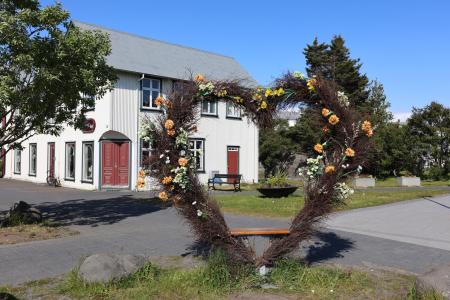
The Heart of Hafnarfjörður
Walk:
4.71km
Difficulty
For Everybody
This scenic walk through Hafnarfjörður begins along the coast and winds through the enchanting…
Hafnarfjörður
Image
Cycling through Hafnarfjörður
Bike:
18.04km
Difficulty
Level 2
Cycling route from Ásvallalaug in Hafnarfjörður via Hvaleyrarvatn, featuring both paved and…
Hafnarfjörður
Image
Elf Circle in Hafnarfjörður
Bike:
6.14km
Difficulty
Level 1
A beautiful cycling route that starts at Hellisgerði and runs through Víðistaðatún, along the…
Hafnarfjörður
Image
Urriðavatn
Walk:
3.21km
Difficulty
Level 1
A short and easy walking route around Urriðavatn in Garðabær. The surroundings of the lake are…
Garðabær
Image
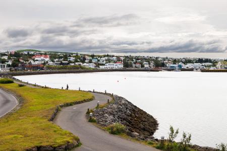
Strandstígur
Walk:
4.07km
Difficulty
For Everybody
Strandstígurinn is a scenic walking path along Hafnarfjörður harbor, featuring beautiful views…
Hafnarfjörður
Image
The Garðabær Circle
Walk:
7.08km
Difficulty
Level 2
This route starts at Vídalínskirkja, passing through historical sites such as Hofsstaðir and…
Garðabær
Image
The Garðabær Circle
Bike:
7.08km
Difficulty
Level 1
A scenic cycling route through the town of Garðabær.
Garðabær