Skip to main content
Út um allt ... höfuðborgarsvæðið
en
is
Filters
(
0
)
Enter a search string
Clear filters
Clear filters
Walk
(-)
Outdoor Area
(-)
Running
Bike
Swimming Pools
Municipality
Reykjavík
(-)
Garðabær
Mosfellsbær
Kópavogur
Hafnarfjörður
Seltjarnarnes
Path Surface
Other
Gravel
Lava
Wood chip
Grass
Facet Path Surface
Duration
30 - 60 minutes
1 - 2 hours
Facet Duration
Difficulty
Level 2
Level 1
Facet Difficulty
Area Access
Dogs allowed
Child-friendly area
Accessible for Disabled
Facet Area Access
Area services
Walking Paths
Cycling Path
Parking
Benches / Resting Area
Waste Bins
Tables and Benches
Culture / History
Toilets
Playground
Drinking Water
EV Charging Station
Water Playground
Football Field
Volleyball Court
Sea Swimming
Frisbee Golf
Exercise Equipment
BBQ Area
BBQ Shelter
Lighting
Artwork
Facet Area services
Area Type
Green Area
Lake
Forest
Sea and Shore
Facet Area Type
Aðstaða
Facet Aðstaða
Home
Hiking Routes
Map of Hiking Routes
Bike Routes
Map of Bike Routes
Running Routes
Map of Running Routes
Outdoor Areas
Map of Outdoor Areas
Swimming Pools
Map of Swimming Pools
About the Website
How do I use the Website?
Visit Reykjavík
Image
Hobbitastígur and Vífilsstaðahlíð
Running:
8.15km
Difficulty
Level 1
An enjoyable trail run in Garðabær starting at the end of Vífilsstaðahlíð, traversing the…
Garðabær
Image
Valahnúkar and Búrfellsgjá
Running:
12.36km
Difficulty
Level 2
A varied trail run through historic lava landscape above Hafnarfjörður and Garðabær. An…
Hafnarfjörður
Garðabær
Image
Búrfell through Búrfellsgjá
Running:
5.64km
Difficulty
Level 2
A short, accessible trail run through Búrfellsgjá up to the Búrfell crater and back. About 5.6…
Garðabær
Image
Vífilsstaðavatn and Vífilsstaðahlíð
Running:
11.31km
Difficulty
Level 2
A varied trail run in Garðabær combining the loop around Vífilsstaðavatn with a climb into…
Garðabær
Image
Hobbitastígur og Vífilshlíð – stutt útgáfa
Running:
5.22km
Difficulty
Level 1
A short, easy beginner's version of the Hobbitastígur loop. An approximately 5.5 km loop by…
Garðabær
Image
The Stjörnuhlaup loop from Miðgarður
Running:
10.87km
Difficulty
Level 2
A popular trail run on the Garðabær side of Heiðmörk, the course of the annual Stjörnuhlaup…
Garðabær
Image
Heiðmörk
Outdoor Area
Heiðmörk is the largest and one of the most popular outdoor recreational areas in the capital…
Municipality
Reykjavík
Garðabær
Image
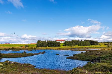
Vífilsstaðavatn
Outdoor Area
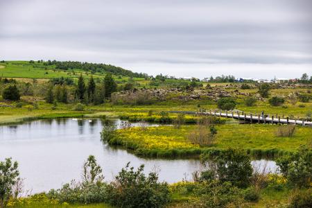
Vífilsstaðavatn, located in Heiðmörk, is a scenic and protected nature reserve with diverse…
Municipality
Garðabær
Image
Urriðavatn
Outdoor Area
Urriðavatn and its surrounding wetlands form a beautiful landscape with diverse vegetation and…
Municipality
Garðabær
Image
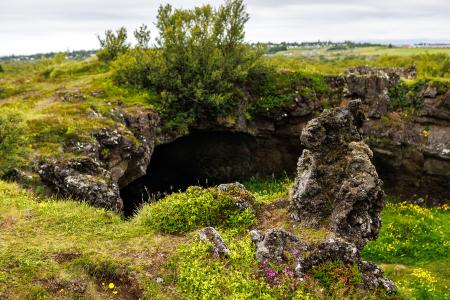
Maríuhellar
Outdoor Area
Maríuhellar in Heiðmörk refer to three caves located in Svínahraun, near the intersection of…
Municipality
Garðabær
Image
Hofsstaðir
Outdoor Area
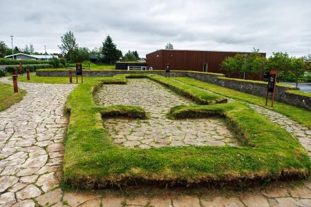
Hofsstaðir in Garðabær is an important archaeological site featuring the remains of a Viking…
Municipality
Garðabær
Image
Sjálandshverfi
Outdoor Area
The beach in the Sjáland neighborhood is a popular outdoor spot with shell sand, a playground,…
Municipality
Garðabær