Skip to main content
Út um allt ... höfuðborgarsvæðið
en
is
Home
Bike and Hiking Routes
Map of Bike and Hiking Routes
Outdoor Areas
Map of Outdoor Areas
About the Website
How do I use the Website?
Visit Reykjavík
2 - 3 hours
A route which takes around 2 - 3 hours
Image
Eldborg, Stóra Kóngsfell and Drottning
Walk:
5.31km
Difficulty
Level 2
A beautiful hiking route that begins at Eldborg in Bláfjöll. The path leads through moss…
Kópavogur
Image
Around Bessastaðatjörn
Walk:
6.50km
Difficulty
Level 1
A walking route around Bessastaðatjörn in a historically rich setting. Along the way, you can…
Garðabær
Image
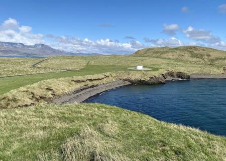
Viðey
Walk:
8.04km
Difficulty
Level 2
The walking route around Viðey is easy and enjoyable, where nature, history, and art…
Reykjavík
Image
The Hjalli Circle in Heiðmörk
Walk:
7.98km
Difficulty
Level 2
The Hjalli Circle in Heiðmörk runs through diverse landscapes, including lava fields and birch…
Reykjavík
Image
The Sun Circle in Heiðmörk
Walk:
5.69km
Difficulty
Level 2
The Sun Circle is a hiking route near Vífilsstaðavatn, located in the scenic Heiðmörk area.
Garðabær
Image
The Garðabær Circle
Walk:
7.08km
Difficulty
Level 2
This route starts at Vídalínskirkja, passing through historical sites such as Hofsstaðir and…
Garðabær
Image
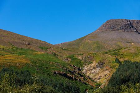
Grímannsfell
Walk:
5.54km
Difficulty
Level 2
Embark on a hike to Mosfellsbær's highest peak and be rewarded with breathtaking views from…
Mosfellsbær
Image
Esjan up to Steinn
Walk:
6.69km
Difficulty
Level 2
The hike up Esjan is probably the most popular hiking trail in the capital area.
Reykjavík
Image
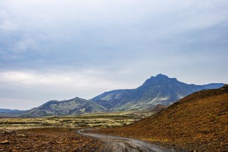
Vífilfell
Walk:
6.70km
Difficulty
Level 3
The hike to Vífilfell, an iconic mountain near the capital area, is a geologically fascinating…
Kópavogur