Skip to main content
Út um allt ... höfuðborgarsvæðið
en
is
Enter a search string
Bike
Walk
Municipality
Reykjavík
Kópavogur
Seltjarnarnes
(-)
Garðabær
(-)
Mosfellsbær
Hafnarfjörður
Path Surface
Other
(-)
Asphalt
Gravel
Grass
Swamp
Rocky
Facet Path Surface
Duration
1 - 2 hours
30 - 60 minutes
30 minutes
2 - 3 hours
3 - 4 hours
Facet Duration
Difficulty
Level 1
Level 2
For Everybody
Level 3
Facet Difficulty
Area Access
Facet Area Access
Area services
Facet Area services
Area Type
Facet Area Type
Home
Bike and Hiking Routes
Map of Bike and Hiking Routes
Outdoor Areas
Map of Outdoor Areas
About the Website
How do I use the Website?
Visit Reykjavík
Image
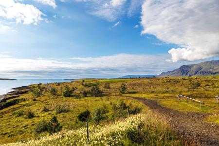
The Álftanes Circle
Bike:
12.47km
Difficulty
Level 2
A light and accessible cycling route around Álftanes, offering views of the sea, peaceful…
Garðabær
Image
Hafravatn
Walk:
5.69km
Difficulty
Level 1
Hafravatn is a beautiful lake in Mosfellsbær. It’s enjoyable to walk around the lake and take…
Mosfellsbær
Image
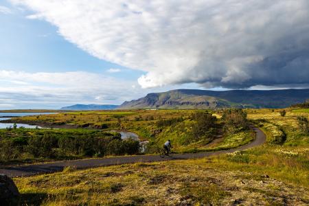
Cycling in Mosfellsbær
Bike:
10.58km
Difficulty
Level 1
An enjoyable cycling route in Mosfellsbær that starts at the Varmár sports area and runs along…
Mosfellsbær
Image
Urriðavatn
Walk:
3.21km
Difficulty
Level 1
A short and easy walking route around Urriðavatn in Garðabær. The surroundings of the lake are…
Garðabær
Image
Blikastaðanes
Walk:
2.93km
Difficulty
For Everybody
A short and beautiful trail suitable for everyone. The walk follows the coastline, offering…
Mosfellsbær
Image
The Garðabær Circle
Walk:
7.08km
Difficulty
Level 2
This route starts at Vídalínskirkja, passing through historical sites such as Hofsstaðir and…
Garðabær
Image
Fossvogur to Gljúfrasteinn
Bike:
45.77km
Difficulty
Level 3
A challenging yet stunning cycling route, spanning from Kópavogur to Mosfellsbær.
Mosfellsbær
Reykjavík
Kópavogur
Image
The Garðabær Circle
Bike:
7.08km
Difficulty
Level 1
A scenic cycling route through the town of Garðabær.
Garðabær