Skip to main content
Út um allt ... höfuðborgarsvæðið
en
is
Enter a search string
Walk
Bike
Municipality
Reykjavík
Mosfellsbær
Hafnarfjörður
(-)
Kópavogur
Garðabær
(-)
Seltjarnarnes
Path Surface
Asphalt
Other
Facet Path Surface
Duration
(-)
1 - 2 hours
30 - 60 minutes
30 minutes
2 - 3 hours
3 - 4 hours
Facet Duration
Difficulty
Level 1
Level 2
For Everybody
Facet Difficulty
Area Access
Facet Area Access
Area services
Facet Area services
Area Type
Facet Area Type
Home
Bike and Hiking Routes
Map of Bike and Hiking Routes
Outdoor Areas
Map of Outdoor Areas
About the Website
How do I use the Website?
Visit Reykjavík
Image
The Linda-Sala Bike Route
Bike:
9.69km
Difficulty
Level 2
A diverse 9 km cycling route through the Linda and Sala neighborhoods, within the historic…
Kópavogur
Image
Fossvogsdalur
Walk:
6.27km
Difficulty
Level 1
The trail provides a great insight into the nature and history of this sheltered valley.
Kópavogur
Reykjavík
Image
Guðmundarlundur and Elliðavatn
Walk:
5.01km
Difficulty
Level 1
This circular hiking route, starting at Guðmundarlundur, goes around the uninhabited…
Kópavogur
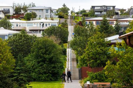
Image
Himnastiginn, Víghóll and Heljarslóð
Walk:
3.46km
Difficulty
Level 1
The route from Digraneskirkja to Víghóll is a scenic and historically rich hike with 207 steps…
Kópavogur
Image
Selfjall and Sandfell
Walk:
6.19km
Difficulty
Level 2
Selfjall and Sandfell are easily accessible and scenic hiking destinations on the outskirts of…
Kópavogur
Image
Seltjarnarnes and golf course
Walk:
7.57km
Difficulty
Level 2
A stunning walking trail that goes around Seltjarnarnes and the golf course near Grótta.
Seltjarnarnes
Image
The Peninsula Circle
Walk:
5.81km
Difficulty
For Everybody
This route leads around Seltjarnarnes, offering breathtaking coastal views, diverse landmarks,…
Seltjarnarnes