Skip to main content
Út um allt ... höfuðborgarsvæðið
en
is
Enter a search string
Walk
Bike
Municipality
Reykjavík
Mosfellsbær
Hafnarfjörður
Kópavogur
(-)
Garðabær
(-)
Seltjarnarnes
Path Surface
Asphalt
Other
Facet Path Surface
Duration
(-)
1 - 2 hours
30 - 60 minutes
2 - 3 hours
30 minutes
3 - 4 hours
Facet Duration
Difficulty
Level 2
For Everybody
Level 1
Facet Difficulty
Area Access
Facet Area Access
Area services
Facet Area services
Area Type
Facet Area Type
Home
Bike and Hiking Routes
Map of Bike and Hiking Routes
Outdoor Areas
Map of Outdoor Areas
About the Website
How do I use the Website?
Visit Reykjavík
Image
The Álftanes Circle
Bike:
12.47km
Difficulty
Level 2
A light and accessible cycling route around Álftanes, offering views of the sea, peaceful…
Garðabær
Image
Fógetastígur in Gálgahraun
Walk:
4.17km
Difficulty
Level 1
A stunning walk around the Gálgahraun lava field, where geological formations, birdlife, and…
Garðabær
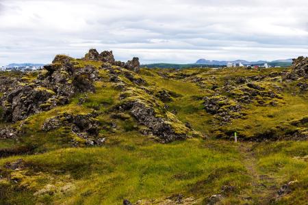
Image
Gunnhildur and Vífilstaðarhlíð
Walk:
6.20km
Difficulty
Level 2
A hike in Heiðmörk which takes you up to the cairn Gunnhildur and follows Vífilsstaðahlíð on…
Garðabær
Image
Seltjarnarnes and golf course
Walk:
7.57km
Difficulty
Level 2
A stunning walking trail that goes around Seltjarnarnes and the golf course near Grótta.
Seltjarnarnes
Image
The Peninsula Circle
Walk:
5.81km
Difficulty
For Everybody
This route leads around Seltjarnarnes, offering breathtaking coastal views, diverse landmarks,…
Seltjarnarnes