Skip to main content
Út um allt ... höfuðborgarsvæðið
en
is
Enter a search string
Bike
Walk
Municipality
Reykjavík
(-)
Kópavogur
Seltjarnarnes
Garðabær
Mosfellsbær
Hafnarfjörður
Path Surface
Other
(-)
Asphalt
Lava
Rocky
Facet Path Surface
Duration
1 - 2 hours
30 - 60 minutes
3 - 4 hours
Facet Duration
Difficulty
Level 1
For Everybody
Level 2
Level 3
Facet Difficulty
Area Access
Facet Area Access
Area services
Facet Area services
Area Type
Facet Area Type
Home
Bike and Hiking Routes
Map of Bike and Hiking Routes
Outdoor Areas
Map of Outdoor Areas
About the Website
How do I use the Website?
Visit Reykjavík
Image
The Linda-Sala Bike Route
Bike:
9.69km
Difficulty
Level 2
A diverse 9 km cycling route through the Linda and Sala neighborhoods, within the historic…
Kópavogur
Image
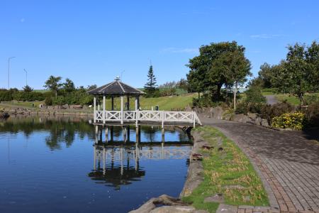
Kópavogsdalur and Kópavogstún
Walk:
3.27km
Difficulty
For Everybody
A short and scenic walking route through Kópavogsdalur and Kópavogstún, well suited for…
Kópavogur
Image
Guðmundarlundur and Elliðavatn
Walk:
5.01km
Difficulty
Level 1
This circular hiking route, starting at Guðmundarlundur, goes around the uninhabited…
Kópavogur
Image
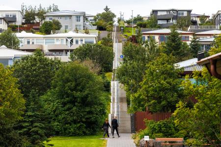
Himnastiginn, Víghóll and Heljarslóð
Walk:
3.46km
Difficulty
Level 1
The route from Digraneskirkja to Víghóll is a scenic and historically rich hike with 207 steps…
Kópavogur
Image
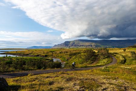
Fossvogur to Gljúfrasteinn
Bike:
45.77km
Difficulty
Level 3
A challenging yet stunning cycling route, spanning from Kópavogur to Mosfellsbær.
Mosfellsbær
Reykjavík
Kópavogur
Image
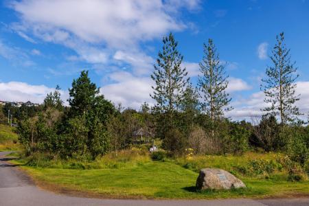
The Kópavogur Circle
Bike:
11.73km
Difficulty
Level 1
A scenic cycling route around Kópavogur, which includes cycling along Kársnes and Fossvogur.
Kópavogur