Skip to main content
Út um allt ... höfuðborgarsvæðið
en
is
Enter a search string
Bike
Walk
Municipality
Reykjavík
Kópavogur
Garðabær
Seltjarnarnes
Mosfellsbær
Hafnarfjörður
Path Surface
Other
(-)
Asphalt
Gravel
Swamp
Lava
Tufts
Rocky
Grass
Facet Path Surface
Duration
1 - 2 hours
3 - 4 hours
2 - 3 hours
Facet Duration
Difficulty
Level 1
For Everybody
(-)
Level 2
(-)
Level 3
Facet Difficulty
Area Access
Facet Area Access
Area services
Facet Area services
Area Type
Facet Area Type
Home
Bike and Hiking Routes
Map of Bike and Hiking Routes
Outdoor Areas
Map of Outdoor Areas
About the Website
How do I use the Website?
Visit Reykjavík
Image
The Álftanes Circle
Bike:
12.47km
Difficulty
Level 2
A light and accessible cycling route around Álftanes, offering views of the sea, peaceful…
Garðabær
Image
The Linda-Sala Bike Route
Bike:
9.69km
Difficulty
Level 2
A diverse 9 km cycling route through the Linda and Sala neighborhoods, within the historic…
Kópavogur
Image
Cycling through Hafnarfjörður
Bike:
18.04km
Difficulty
Level 2
Cycling route from Ásvallalaug in Hafnarfjörður via Hvaleyrarvatn, featuring both paved and…
Hafnarfjörður
Image
The Garðabær Circle
Walk:
7.08km
Difficulty
Level 2
This route starts at Vídalínskirkja, passing through historical sites such as Hofsstaðir and…
Garðabær
Image
Seltjarnarnes and golf course
Walk:
7.57km
Difficulty
Level 2
A stunning walking trail that goes around Seltjarnarnes and the golf course near Grótta.
Seltjarnarnes
Image
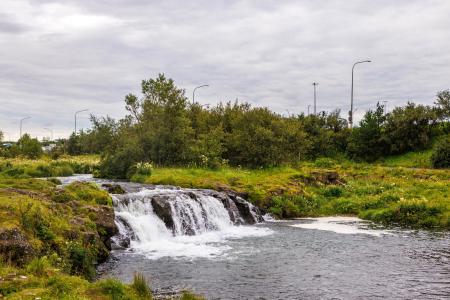
Elliðaárdalur
Bike:
8.19km
Difficulty
Level 2
A bike tour through Elliðaárdalur with scenic river paths, surrounded by lush greenery and…
Reykjavík
Image
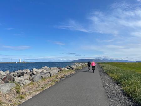
Around Reykjavik and Seltjarnarnes
Bike:
25.99km
Difficulty
Level 3
A popular and scenic cycling route around Reykjavík and Seltjarnarnes.
Reykjavík
Seltjarnarnes
Image
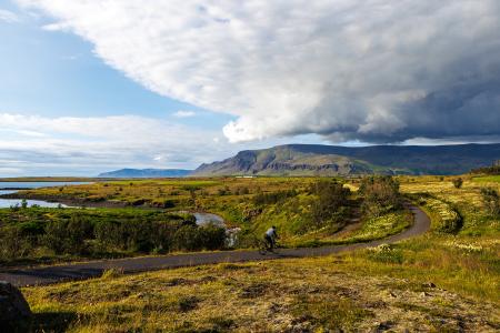
Fossvogur to Gljúfrasteinn
Bike:
45.77km
Difficulty
Level 3
A challenging yet stunning cycling route, spanning from Kópavogur to Mosfellsbær.
Mosfellsbær
Reykjavík
Kópavogur