Skip to main content
Út um allt ... höfuðborgarsvæðið
en
is
Enter a search string
Walk
Bike
Municipality
Reykjavík
Kópavogur
Garðabær
Mosfellsbær
Hafnarfjörður
Seltjarnarnes
Path Surface
Other
Asphalt
Gravel
Swamp
Lava
Tufts
Rocky
Grass
Facet Path Surface
Duration
1 - 2 hours
2 - 3 hours
3 - 4 hours
30 - 60 minutes
Facet Duration
Difficulty
Level 1
(-)
Level 2
For Everybody
(-)
Level 3
Facet Difficulty
Area Access
Facet Area Access
Area services
Facet Area services
Area Type
Facet Area Type
Home
Bike and Hiking Routes
Map of Bike and Hiking Routes
Outdoor Areas
Map of Outdoor Areas
About the Website
How do I use the Website?
Visit Reykjavík
Image
The Sun Circle in Heiðmörk
Walk:
5.69km
Difficulty
Level 2
The Sun Circle is a hiking route near Vífilsstaðavatn, located in the scenic Heiðmörk area.
Garðabær
Image
Strípur in Heiðmörk
Walk:
4.28km
Difficulty
Level 2
Strípshringur is a trail in Heiðmörk which runs through well-vegetated forested areas and open…
Reykjavík
Image
Selfjall and Sandfell
Walk:
6.19km
Difficulty
Level 2
Selfjall and Sandfell are easily accessible and scenic hiking destinations on the outskirts of…
Kópavogur
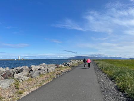
Image
Around Reykjavik and Seltjarnarnes
Bike:
25.99km
Difficulty
Level 3
A popular and scenic cycling route around Reykjavík and Seltjarnarnes.
Reykjavík
Seltjarnarnes
Image
Móskarðshnjúkar
Walk:
8.03km
Difficulty
Level 3
Móskarðshnjúkar are two majestic peaks east of Esja, offering a challenging but well-marked…
Reykjavík
Image
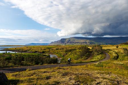
Fossvogur to Gljúfrasteinn
Bike:
45.77km
Difficulty
Level 3
A challenging yet stunning cycling route, spanning from Kópavogur to Mosfellsbær.
Mosfellsbær
Reykjavík
Kópavogur
Image
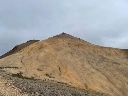
Vífilfell
Walk:
6.70km
Difficulty
Level 3
The hike to Vífilfell, an iconic mountain near the capital area, is a geologically fascinating…
Kópavogur
Pagination
First page
« First
Previous page
‹‹
Page
1
Page
2