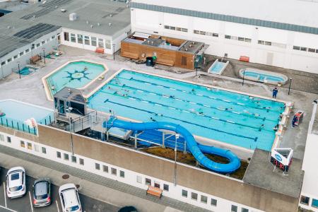
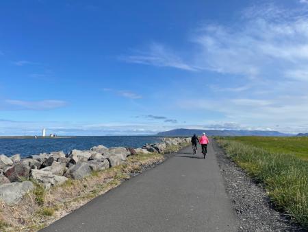
Home
Út um allt ... höfuðborgarsvæðið
  • en
  • is
Enter a search string
  • Home
  • Bike and Hiking Routes
    • Map of Bike and Hiking Routes
  • Outdoor Areas
    • Map of Outdoor Areas
  • About the Website
    • How do I use the Website?
  • Visit Reykjavík
  • Image

    Bakkagarður

    Outdoor Area
    Bakkagarður boasts a playground with diverse play equipment, such as swings and slides. The…
    Municipality
    Seltjarnarnes
  • Image

    Vestursvæðin

    Outdoor Area
    Vestursvæðin is an outdoor area featuring diverse birdlife, scenic walking and cycling paths,…
    Municipality
    Seltjarnarnes
  • Image

    Valhúsahæð

    Outdoor Area
    Valhúsahæð, the highest point in Seltjarnarnes at 31 meters above sea level, is a popular…
    Municipality
    Seltjarnarnes
  • Image

    Plútóbrekka

    Outdoor Area
    Plútóbrekkan, located below Seltjarnarneskirkja, is a popular spot for winter sledding and…
    Municipality
    Seltjarnarnes
  • Image

    Grótta

    Outdoor Area
    Grótta is a scenic, land-connected island off the western coast of Seltjarnarnes, known for…
    Municipality
    Seltjarnarnes
  • Image

    The Peninsula Circle

    Walk:
    5.81km
    Difficulty
    For Everybody
    This route leads around Seltjarnarnes, offering breathtaking coastal views, diverse landmarks,…
    Seltjarnarnes
  • Image

    The Seltjarnarnes Circle

    Walk:
    3.55km
    Difficulty
    For Everybody
    A short and scenic walking route from the Seltjarnarnes swimming pool, following the northern…
    Seltjarnarnes
  • Image

    Seltjarnarnes and golf course

    Bike:
    7.57km
    Difficulty
    Level 1
    A cycling route that loops around Seltjarnarnes and the golf course, offering scenic coastal…
    Seltjarnarnes
  • Image

    Seltjarnarnes and golf course

    Walk:
    7.57km
    Difficulty
    Level 2
    A stunning walking trail that goes around Seltjarnarnes and the golf course near Grótta.
    Seltjarnarnes
info@visitreykjavik.is