Skip to main content
Út um allt ... höfuðborgarsvæðið
en
is
Enter a search string
Walk
Outdoor Area
Bike
Municipality
Reykjavík
(-)
Mosfellsbær
Kópavogur
Garðabær
Hafnarfjörður
(-)
Seltjarnarnes
Path Surface
Other
Asphalt
Gravel
Swamp
Rocky
Grass
Facet Path Surface
Duration
1 - 2 hours
30 - 60 minutes
3 - 4 hours
30 minutes
2 - 3 hours
Facet Duration
Difficulty
Level 1
Level 2
For Everybody
Level 3
Facet Difficulty
Area Access
Child-friendly area
Dogs allowed
Accessible for Disabled
Facet Area Access
Area services
Walking Paths
Parking
Benches / Resting Area
Cycling Path
Waste Bins
Tables and Benches
Playground
Lighting
Frisbee Golf
Drinking Water
Dog Playground
Swimming Pool
Bouncy Castle
Exercise Equipment
Artwork
Culture / History
No Service
Toilets
Football Field
Volleyball Court
BBQ Area
Restaurant / Café
Facet Area services
Area Type
Green Area
Sea and Shore
Forest
Lake
History and/or Culture
Facet Area Type
Home
Bike and Hiking Routes
Map of Bike and Hiking Routes
Outdoor Areas
Map of Outdoor Areas
About the Website
How do I use the Website?
Visit Reykjavík
Image
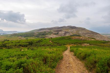
Reykjaborg and Lali
Walk:
6.86km
Difficulty
Level 2
The two mountains Reykjaborg and Lali are neither steep nor high, making them ideal for a…
Mosfellsbær
Image
Hafravatn
Outdoor Area
Hafravatn in Mosfellsbær is a peaceful and beautiful outdoor recreation area located just east…
Municipality
Mosfellsbær
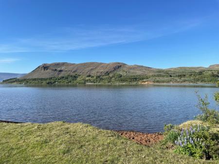
Image
Hafravatn
Walk:
5.69km
Difficulty
Level 1
Hafravatn is a beautiful lake in Mosfellsbær. It’s enjoyable to walk around the lake and take…
Mosfellsbær
Image
Cycling in Mosfellsbær
Bike:
10.58km
Difficulty
Level 1
An enjoyable cycling route in Mosfellsbær that starts at the Varmár sports area and runs along…
Mosfellsbær
Image
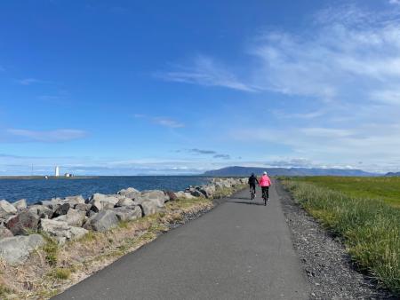
Around Reykjavik and Seltjarnarnes
Bike:
25.99km
Difficulty
Level 3
A popular and scenic cycling route around Reykjavík and Seltjarnarnes.
Reykjavík
Seltjarnarnes
Image
Úlfarsfell from Skarhólabraut
Walk:
3.55km
Difficulty
Level 1
A well-marked and family-friendly hiking trail from Skarhólabraut up to the top of Úlfarsfell…
Mosfellsbær
Reykjavík
Image
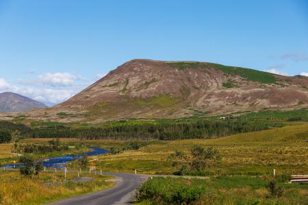
Mosfell
Walk:
3.75km
Difficulty
Level 1
The path up Mosfell is a well-marked and family-friendly circular hiking route with scenic…
Mosfellsbær
Image
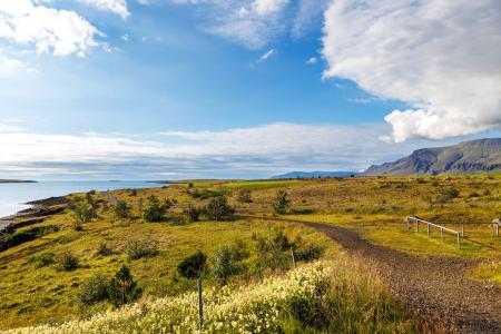
Blikastaðanes
Walk:
2.93km
Difficulty
For Everybody
A short and beautiful trail suitable for everyone. The walk follows the coastline, offering…
Mosfellsbær
Image
Helgafell in Mosfellsbær
Walk:
1.89km
Difficulty
Level 1
The hike to Helgafell is a short and enjoyable trek, offering scenic views of Esja,…
Mosfellsbær
Image
Æsustaðafell and Reykjafell
Walk:
6.32km
Difficulty
Level 2
The hike to Æsustaðafjall and Reykjafell is a family-friendly loop in Mosfellsdalur, featuring…
Mosfellsbær
Image
Grímannsfell
Walk:
5.54km
Difficulty
Level 2
Embark on a hike to Mosfellsbær's highest peak and be rewarded with breathtaking views from…
Mosfellsbær
Image
Seltjarnarnes and golf course
Walk:
7.57km
Difficulty
Level 2
A stunning walking trail that goes around Seltjarnarnes and the golf course near Grótta.
Seltjarnarnes
Image
The Seltjarnarnes Circle
Walk:
3.55km
Difficulty
For Everybody
A short and scenic walking route from the Seltjarnarnes swimming pool, following the northern…
Seltjarnarnes
Image
The Peninsula Circle
Walk:
5.81km
Difficulty
For Everybody
This route leads around Seltjarnarnes, offering breathtaking coastal views, diverse landmarks,…
Seltjarnarnes
Image
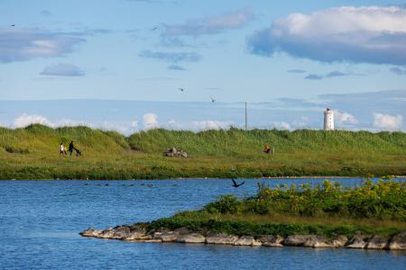
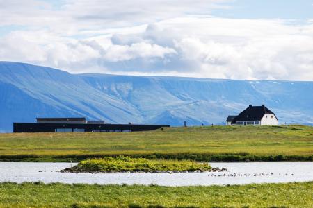
Grótta
Outdoor Area
Grótta is a scenic, land-connected island off the western coast of Seltjarnarnes, known for…
Municipality
Seltjarnarnes
Image
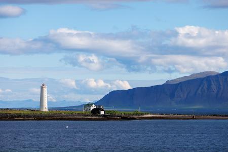
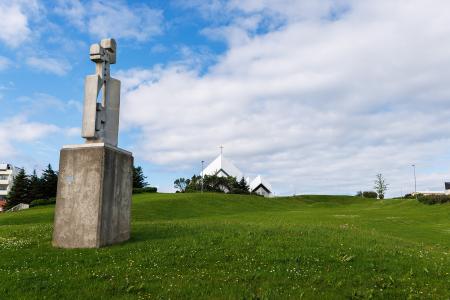
Valhúsahæð
Outdoor Area
Valhúsahæð, the highest point in Seltjarnarnes at 31 meters above sea level, is a popular…
Municipality
Seltjarnarnes
Image
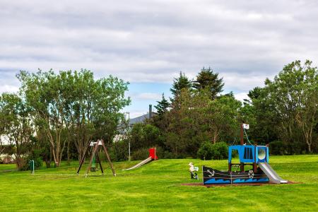
Bakkagarður
Outdoor Area
Bakkagarður boasts a playground with diverse play equipment, such as swings and slides. The…
Municipality
Seltjarnarnes
Image
Plútóbrekka
Outdoor Area
Plútóbrekkan, located below Seltjarnarneskirkja, is a popular spot for winter sledding and…
Municipality
Seltjarnarnes
Image
Vestursvæðin
Outdoor Area
Vestursvæðin is an outdoor area featuring diverse birdlife, scenic walking and cycling paths,…
Municipality
Seltjarnarnes
Image
Úlfarsfell
Walk:
4.34km
Difficulty
Level 1
Úlfarsfell is a popular and easily accessible hiking destination on the border of Reykjavík…
Mosfellsbær
Reykjavík
Pagination
Page
1
Page
2
Next page
››
Last page
Last »