Skip to main content
Út um allt ... höfuðborgarsvæðið
en
is
Enter a search string
Walk
Bike
Municipality
Reykjavík
Mosfellsbær
Kópavogur
Hafnarfjörður
Garðabær
Seltjarnarnes
Path Surface
Other
Asphalt
Gravel
Grass
Rocky
Swamp
Lava
Tufts
Facet Path Surface
Duration
(-)
1 - 2 hours
30 - 60 minutes
(-)
2 - 3 hours
30 minutes
3 - 4 hours
Facet Duration
Difficulty
Level 2
Level 1
For Everybody
Level 3
Facet Difficulty
Area Access
Facet Area Access
Area services
Facet Area services
Area Type
Facet Area Type
Home
Bike and Hiking Routes
Map of Bike and Hiking Routes
Outdoor Areas
Map of Outdoor Areas
About the Website
How do I use the Website?
Visit Reykjavík
Image
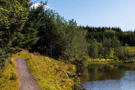
The Water Circle in Heiðmörk
Walk:
7.56km
Difficulty
Level 2
The Water Circle in Heiðmörk is a scenic walking and running route marked with blue posts,…
Reykjavík
Image
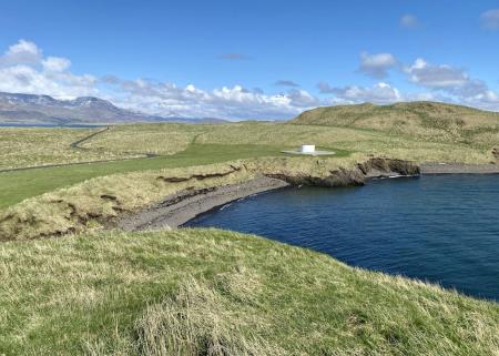
Seltjarnarnes and golf course
Walk:
7.57km
Difficulty
Level 2
A stunning walking trail that goes around Seltjarnarnes and the golf course near Grótta.
Seltjarnarnes
Image
The Peninsula Circle
Walk:
5.81km
Difficulty
For Everybody
This route leads around Seltjarnarnes, offering breathtaking coastal views, diverse landmarks,…
Seltjarnarnes
Image
Úlfarsfell
Walk:
4.34km
Difficulty
Level 1
Úlfarsfell is a popular and easily accessible hiking destination on the border of Reykjavík…
Mosfellsbær
Reykjavík
Image
Fossvogsdalur
Walk:
6.27km
Difficulty
Level 1
The trail provides a great insight into the nature and history of this sheltered valley.
Kópavogur
Reykjavík
Image
Guðmundarlundur and Elliðavatn
Walk:
5.01km
Difficulty
Level 1
This circular hiking route, starting at Guðmundarlundur, goes around the uninhabited…
Kópavogur
Image
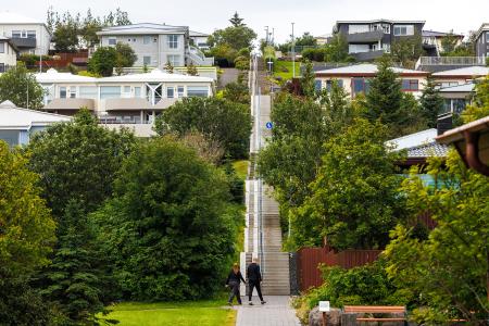
Himnastiginn, Víghóll and Heljarslóð
Walk:
3.46km
Difficulty
Level 1
The route from Digraneskirkja to Víghóll is a scenic and historically rich hike with 207 steps…
Kópavogur
Image
The Reykjavík Circle
Bike:
18.53km
Difficulty
Level 1
A fun cycling loop around Reykjavík, passing by many of the city's main landmarks.
Reykjavík
Image
Elliðaárdalur
Bike:
8.19km
Difficulty
Level 2
A bike tour through Elliðaárdalur with scenic river paths, surrounded by lush greenery and…
Reykjavík
Image
Strípur in Heiðmörk
Walk:
4.28km
Difficulty
Level 2
Strípshringur is a trail in Heiðmörk which runs through well-vegetated forested areas and open…
Reykjavík
Image
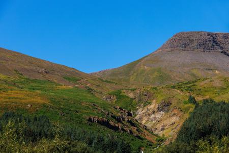
Selfjall and Sandfell
Walk:
6.19km
Difficulty
Level 2
Selfjall and Sandfell are easily accessible and scenic hiking destinations on the outskirts of…
Kópavogur
Image
The Hjalli Circle in Heiðmörk
Walk:
7.98km
Difficulty
Level 2
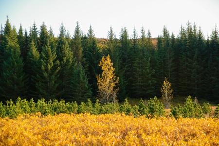
The Hjalli Circle in Heiðmörk runs through diverse landscapes, including lava fields and birch…
Reykjavík
Image
Esjan up to Steinn
Walk:
6.69km
Difficulty
Level 2
The hike up Esjan is probably the most popular hiking trail in the capital area.
Reykjavík
Image
Viðey
Walk:
8.04km
Difficulty
Level 2
The walking route around Viðey is easy and enjoyable, where nature, history, and art…
Reykjavík
Image
Around Bessastaðatjörn
Walk:
6.50km
Difficulty
Level 1
A walking route around Bessastaðatjörn in a historically rich setting. Along the way, you can…
Garðabær
Image
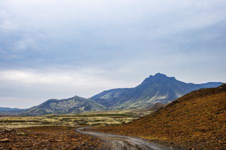
Eldborg, Stóra Kóngsfell and Drottning
Walk:
5.31km
Difficulty
Level 2
A beautiful hiking route that begins at Eldborg in Bláfjöll. The path leads through moss…
Kópavogur
Image
Grímannsfell
Walk:
5.54km
Difficulty
Level 2
Embark on a hike to Mosfellsbær's highest peak and be rewarded with breathtaking views from…
Mosfellsbær
Image
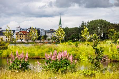
The Garðabær Circle
Walk:
7.08km
Difficulty
Level 2
This route starts at Vídalínskirkja, passing through historical sites such as Hofsstaðir and…
Garðabær
Image
Vífilfell
Walk:
6.70km
Difficulty
Level 3
The hike to Vífilfell, an iconic mountain near the capital area, is a geologically fascinating…
Kópavogur
Image
The Sun Circle in Heiðmörk
Walk:
5.69km
Difficulty
Level 2
The Sun Circle is a hiking route near Vífilsstaðavatn, located in the scenic Heiðmörk area.
Garðabær
Pagination
First page
« First
Previous page
‹‹
Page
1
Page
2