Skip to main content
Út um allt ... höfuðborgarsvæðið
en
is
Síur
(
0
)
Enter a search string
Hreinsa síur
Hreinsa síur
Walk
Outdoor Area
Bike
Municipality
Reykjavík
Mosfellsbær
Kópavogur
Garðabær
Hafnarfjörður
Seltjarnarnes
Path Surface
Other
Asphalt
Gravel
Grass
Swamp
Rocky
Lava
Tufts
Facet Path Surface
Duration
1 - 2 hours
30 - 60 minutes
2 - 3 hours
30 minutes
3 - 4 hours
Facet Duration
Difficulty
Level 1
Level 2
For Everybody
Level 3
Facet Difficulty
Area Access
Child-friendly area
Dogs allowed
Accessible for Disabled
Facet Area Access
Area services
Walking Paths
Parking
Benches / Resting Area
Waste Bins
Cycling Path
Tables and Benches
Playground
Toilets
Lighting
Artwork
Culture / History
Drinking Water
Exercise Equipment
BBQ Area
Frisbee Golf
Bouncy Castle
Football Field
Volleyball Court
Restaurant / Café
Water Playground
BBQ Shelter
Basketball Court
Swimming Pool
EV Charging Station
Dog Playground
Park
Toddler Playground
Sea Swimming
Mini Golf
No Service
Facet Area services
Area Type
Green Area
Lake
Forest
Sea and Shore
History and/or Culture
Facet Area Type
Home
Bike and Hiking Routes
Map of Bike and Hiking Routes
Outdoor Areas
Map of Outdoor Areas
Sundlaugar
About the Website
How do I use the Website?
Visit Reykjavík
Image
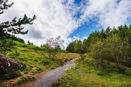
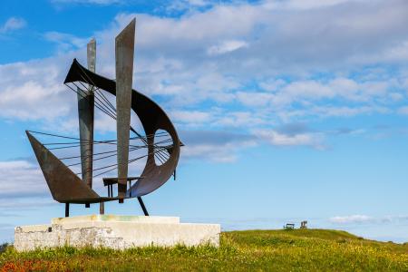
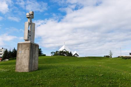
The Garðabær Circle
Walk:
7.08km
Difficulty
Level 2
This route starts at Vídalínskirkja, passing through historical sites such as Hofsstaðir and…
Garðabær
Image
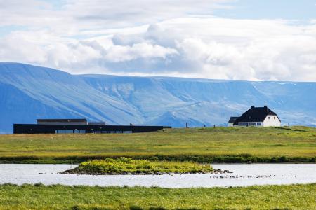
Gunnhildur and Vífilstaðarhlíð
Walk:
6.20km
Difficulty
Level 2
A hike in Heiðmörk which takes you up to the cairn Gunnhildur and follows Vífilsstaðahlíð on…
Garðabær
Image
Hólmsheiði and Rauðavatn
Walk:
5.23km
Difficulty
Level 2
This scenic hike around Hólmsheiði and Rauðavatn leads through a diverse landscape of…
Reykjavík
Image
The Water Circle in Heiðmörk
Walk:
7.56km
Difficulty
Level 2
The Water Circle in Heiðmörk is a scenic walking and running route marked with blue posts,…
Reykjavík
Image
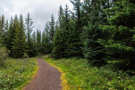
The Forest Circle in Heiðmörk
Walk:
3.50km
Difficulty
Level 1
The Forest Circle in Heiðmörk is a highly enjoyable and family-friendly hiking trail, spanning…
Reykjavík
Image
Seltjarnarnes and golf course
Walk:
7.57km
Difficulty
Level 2
A stunning walking trail that goes around Seltjarnarnes and the golf course near Grótta.
Seltjarnarnes
Image
The Seltjarnarnes Circle
Walk:
3.55km
Difficulty
For Everybody
A short and scenic walking route from the Seltjarnarnes swimming pool, following the northern…
Seltjarnarnes
Image
The Elliðaárdalur Circle
Walk:
2.48km
Difficulty
Level 1
A perfect family walk through the beautiful Hólmi area in Elliðaárdalur, offering scenic…
Reykjavík
Image
The Peninsula Circle
Walk:
5.81km
Difficulty
For Everybody
This route leads around Seltjarnarnes, offering breathtaking coastal views, diverse landmarks,…
Seltjarnarnes
Image
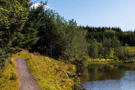
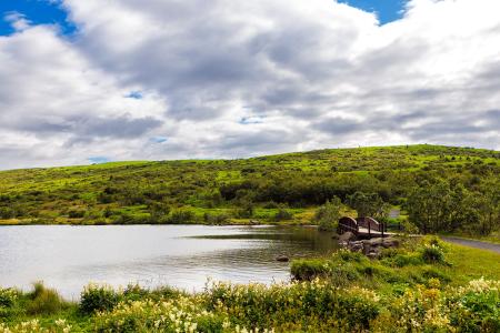
Vífilsstaðavatn
Walk:
2.62km
Difficulty
Level 1
A short and enjoyable walking trail around Vífilsstaðavatn, perfect for anyone looking to…
Garðabær
Image
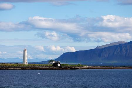
Grótta
Outdoor Area
Grótta is a scenic, land-connected island off the western coast of Seltjarnarnes, known for…
Municipality
Seltjarnarnes
Image
Valhúsahæð
Outdoor Area
Valhúsahæð, the highest point in Seltjarnarnes at 31 meters above sea level, is a popular…
Municipality
Seltjarnarnes
Image
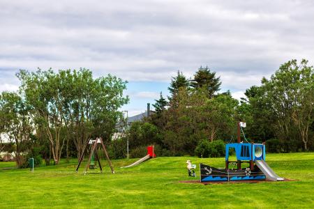
Bakkagarður
Outdoor Area
Bakkagarður boasts a playground with diverse play equipment, such as swings and slides. The…
Municipality
Seltjarnarnes
Image
Plútóbrekka
Outdoor Area
Plútóbrekkan, located below Seltjarnarneskirkja, is a popular spot for winter sledding and…
Municipality
Seltjarnarnes
Image
Vestursvæðin
Outdoor Area
Vestursvæðin is an outdoor area featuring diverse birdlife, scenic walking and cycling paths,…
Municipality
Seltjarnarnes
Image
Elliðaárdalur
Outdoor Area
Elliðaárdalurinn is one of the largest green areas within the urban core of Reykjavík and is…
Municipality
Reykjavík
Image
Laugardalur
Outdoor Area
Laugardalur valley and park is undoubtedly one of the most popular outdoor areas of Reykjavik,…
Municipality
Reykjavík
Image
Úlfarsfell
Walk:
4.34km
Difficulty
Level 1
Úlfarsfell is a popular and easily accessible hiking destination on the border of Reykjavík…
Mosfellsbær
Reykjavík
Image
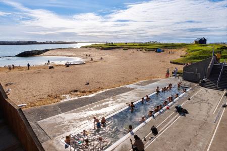
Nauthólsvík
Outdoor Area
Nauthólsvík Geothermal Beach is a paradise for people who love splashing around in the ocean…
Municipality
Reykjavík
Image
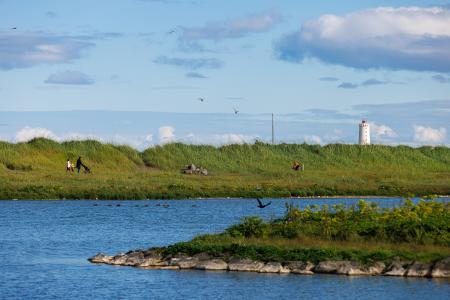
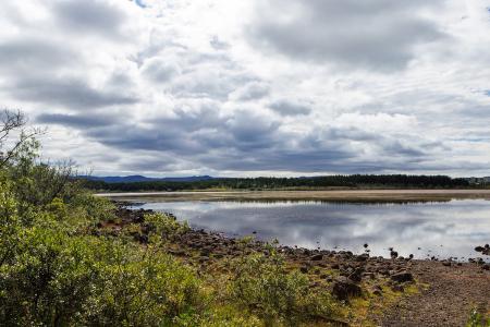
Rauðavatn
Outdoor Area
Rauðavatn is part of Austurheiðar, a vast region with numerous popular hiking trails,…
Municipality
Reykjavík
Pagination
First page
« First
Previous page
‹‹
Page
1
Page
2
Page
3
Page
4
Page
5
Page
6
Page
7
Page
8
Page
9
…
Next page
››
Last page
Last »