Skip to main content
Út um allt ... höfuðborgarsvæðið
en
is
Enter a search string
Walk
Bike
Municipality
Reykjavík
Mosfellsbær
Hafnarfjörður
Kópavogur
Garðabær
Path Surface
(-)
Other
Asphalt
Gravel
Swamp
Rocky
Grass
Facet Path Surface
Duration
(-)
1 - 2 hours
2 - 3 hours
(-)
30 - 60 minutes
30 minutes
3 - 4 hours
Facet Duration
Difficulty
Level 1
Level 2
Facet Difficulty
Area Access
Facet Area Access
Area services
Facet Area services
Area Type
Facet Area Type
Home
Bike and Hiking Routes
Map of Bike and Hiking Routes
Outdoor Areas
Map of Outdoor Areas
About the Website
How do I use the Website?
Visit Reykjavík
Image
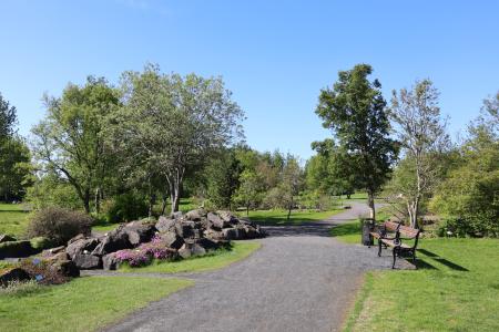
Laugardalur
Walk:
2.92km
Difficulty
Level 1
A light and accessible walking route that starts at Laugardalslaug Swimming Pool. The path…
Reykjavík
Image
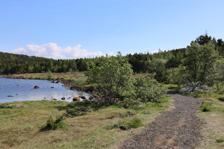
Reynisvatn
Walk:
1.49km
Difficulty
Level 1
A light and beautiful walking trail in a peaceful environment by Reynisvatn, east of…
Reykjavík
Image
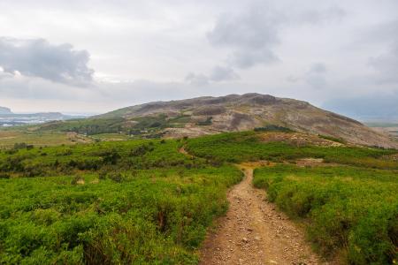
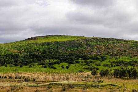
Helgafell in Mosfellsbær
Walk:
1.89km
Difficulty
Level 1
The hike to Helgafell is a short and enjoyable trek, offering scenic views of Esja,…
Mosfellsbær
Image
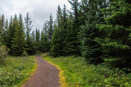
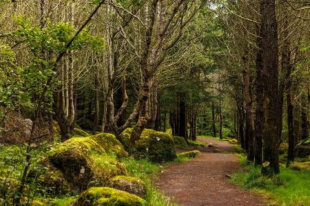
The Forest Circle in Heiðmörk
Walk:
3.50km
Difficulty
Level 1
The Forest Circle in Heiðmörk is a highly enjoyable and family-friendly hiking trail, spanning…
Reykjavík
Image
The Elliðaárdalur Circle
Walk:
2.48km
Difficulty
Level 1
A perfect family walk through the beautiful Hólmi area in Elliðaárdalur, offering scenic…
Reykjavík
Image
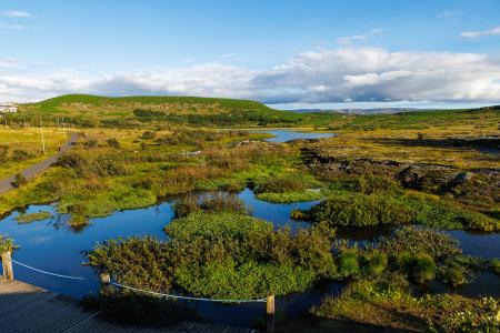
The Water Circle in Heiðmörk
Bike:
7.56km
Difficulty
Level 1
A scenic cycling route in Heiðmörk marked with blue posts, passing by lakes and educational…
Reykjavík
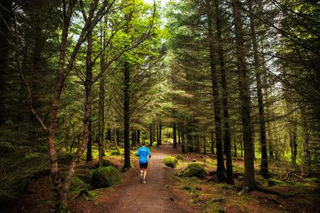
Image
Öskjuhlíð
Bike:
5.99km
Difficulty
Level 2
This bike trail in Öskjuhlíð offers a scenic ride through forested areas and historical…
Reykjavík
Image
Öskjuhlíð
Walk:
5.99km
Difficulty
Level 2
Öskjuhlíð is a unique recreational area near downtown Reykjavík with diverse nature and…
Reykjavík
Image
Around Helgafell in Hafnarfjörður
Walk:
8.34km
Difficulty
Level 2
The hike up Helgafell in Hafnarfjörður is very popular among locals, but walking the scenic…
Hafnarfjörður
Image
Reykjaborg and Lali
Walk:
6.86km
Difficulty
Level 2
The two mountains Reykjaborg and Lali are neither steep nor high, making them ideal for a…
Mosfellsbær
Image
Hafravatn
Walk:
5.69km
Difficulty
Level 1
Hafravatn is a beautiful lake in Mosfellsbær. It’s enjoyable to walk around the lake and take…
Mosfellsbær
Image
Cycling in Mosfellsbær
Bike:
10.58km
Difficulty
Level 1
An enjoyable cycling route in Mosfellsbær that starts at the Varmár sports area and runs along…
Mosfellsbær
Image
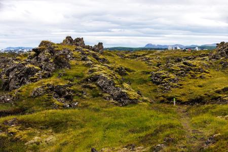
Fógetastígur in Gálgahraun
Walk:
4.17km
Difficulty
Level 1
A stunning walk around the Gálgahraun lava field, where geological formations, birdlife, and…
Garðabær
Image
Úlfarsfell from Skarhólabraut
Walk:
3.55km
Difficulty
Level 1
A well-marked and family-friendly hiking trail from Skarhólabraut up to the top of Úlfarsfell…
Mosfellsbær
Reykjavík
Image
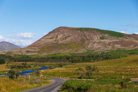
Mosfell
Walk:
3.75km
Difficulty
Level 1
The path up Mosfell is a well-marked and family-friendly circular hiking route with scenic…
Mosfellsbær
Image
Helgafell in Hafnarfjörður
Walk:
5.74km
Difficulty
Level 2
The ascent of Helgafellíð ranks among the most favored hikes in the capital region, offering a…
Hafnarfjörður
Image
Æsustaðafell and Reykjafell
Walk:
6.32km
Difficulty
Level 2
The hike to Æsustaðafjall and Reykjafell is a family-friendly loop in Mosfellsdalur, featuring…
Mosfellsbær
Image
Stórhöfði
Walk:
4.79km
Difficulty
Level 1
The Stórhöfði loop near Hvaleyrarvatn is a family-friendly hike with scenic views of Helgafell…
Hafnarfjörður
Image
Ásfjall and Ástjörn
Walk:
4.25km
Difficulty
Level 1
Ásfjall is renowned as one of the most scenic mountains in the capital area due to the clear…
Hafnarfjörður
Image
Gunnhildur and Vífilstaðarhlíð
Walk:
6.20km
Difficulty
Level 2
A hike in Heiðmörk which takes you up to the cairn Gunnhildur and follows Vífilsstaðahlíð on…
Garðabær
Pagination
Page
1
Page
2
Next page
››
Last page
Last »