Skip to main content
Út um allt ... höfuðborgarsvæðið
en
is
Home
Hiking Routes
Map of Hiking Routes
Bike Routes
Map of Bike Routes
Running Routes
Map of Running Routes
Outdoor Areas
Map of Outdoor Areas
Swimming Pools
Map of Swimming Pools
About the Website
How do I use the Website?
Visit Reykjavík
30 - 60 minutes
A route which takes around 30 - 60 minutes
Image
Airport loop from Vesturbæjarlaug
Running:
8.19km
Difficulty
Level 1
An easy, accessible run on paved paths from Vesturbæjarlaug around Reykjavík Airport in…
Reykjavík
Image
Airport loop from Sundhöllin
Running:
8.45km
Difficulty
Level 1
An easy, accessible urban run on paved paths from Sundhöll Reykjavíkur around Reykjavík…
Reykjavík
Image
Garðabæjarhringur from Vídalínskirkja
Running:
7.08km
Difficulty
Level 2
A varied running route around Garðabær starting at Vídalínskirkja, passing historical sites…
Garðabær
Image
Öskjuhlíð
Running:
5.99km
Difficulty
Level 2
Öskjuhlíð is a unique recreational area close to central Reykjavík with varied nature and…
Reykjavík
Image
Úlfarsfell from Úlfarsfellsvegur
Running:
4.34km
Difficulty
Level 2
A popular running route up Úlfarsfell from Úlfarsfellsvegur, on the boundary of Reykjavík and…
Mosfellsbær
Reykjavík
Image
Neshringur from Seltjarnarneslaug
Running:
5.42km
Difficulty
Level 1
A beautiful, flat running route around Seltjarnarnes with spectacular coastal views. A 5.4 km…
Seltjarnarnes
Image
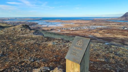
Around Helgafell in Hafnarfjörður
Running:
8.34km
Difficulty
Level 2
An enjoyable running route circling Helgafell in Hafnarfjörður, a striking tuff stack. An 8.3…
Hafnarfjörður
Image
Vatnsendahlíð from Guðmundarlundur
Running:
5.64km
Difficulty
Level 2
A varied trail run through the uninhabited Vatnsendahlíð, from the Guðmundarlundur woodland in…
Kópavogur
Image
Hobbitastígur og Vífilshlíð – stutt útgáfa
Running:
5.22km
Difficulty
Level 1
A short, easy beginner's version of the Hobbitastígur loop. An approximately 5.5 km loop by…
Garðabær
Image
Búrfell through Búrfellsgjá
Running:
5.64km
Difficulty
Level 2
A short, accessible trail run through Búrfellsgjá up to the Búrfell crater and back. About 5.6…
Garðabær
Image
Kársnes loop from Kópavogslaug
Running:
5.74km
Difficulty
Level 1
An easy, accessible run on a paved coastal path around Kársnes, the westernmost part of…
Kópavogur
Image
The little Ríkishringur in Heiðmörk
Running:
5.99km
Difficulty
Level 1
A short, easy trail run in Heiðmörk, a shorter version of the well-known Ríkishringur. An…
Reykjavík
Image
Forest loop in Esja
Running:
5.03km
Difficulty
Level 2
An enjoyable, sheltered trail run through the forestry area in the Esja slopes by Mógilsá,…
Reykjavík
Image
Helgafell Circle from Varmárlaug
Running:
8.25km
Difficulty
Level 2
An enjoyable mountain run on Helgafell in Mosfellsbær (216 m), starting at the Varmá sports…
Mosfellsbær
Image
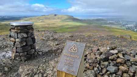
Lali and Reykjaborg
Running:
4.48km
Difficulty
Level 2
A short but steep mountain run over two of Mosfellsbær's marked summits, Reykjaborg (286 m)…
Mosfellsbær
Image
Norðmannahringur í Heiðmörk
Walk:
2.06km
Difficulty
Level 1
The Norðmannahringur (Norwegian Trail) is a nearly 2 km circular walking route through a…
Reykjavík
Image
Hobbitastígur and Vífilsstaðahlíð
Running:
8.15km
Difficulty
Level 1
An enjoyable trail run in Garðabær starting at the end of Vífilsstaðahlíð, traversing the…
Garðabær
Image
Úlfarsfell from the forestry area
Running:
5.70km
Difficulty
Level 2
A popular trail run up Úlfarsfell, starting at the Hamrahlíð forestry area on the mountain's…
Mosfellsbær
Image
Urriðavatn
Walk:
3.21km
Difficulty
Level 1
A short and easy walking route around Urriðavatn in Garðabær. The surroundings of the lake are…
Garðabær
Image
Kópavogsdalur and Kópavogstún
Walk:
3.27km
Difficulty
For Everybody
A short and scenic walking route through Kópavogsdalur and Kópavogstún, well suited for…
Kópavogur
Image
Reynisvatn
Walk:
1.49km
Difficulty
Level 1
A light and beautiful walking trail in a peaceful environment by Reynisvatn, east of…
Reykjavík
Image
Laugardalur
Walk:
2.92km
Difficulty
Level 1
A light and accessible walking route that starts at Laugardalslaug Swimming Pool. The path…
Reykjavík
Image
Æðisíða
Walk:
3.06km
Difficulty
For Everybody
An easy and enjoyable walking path along Ægisíða that starts at the Vesturbær Swimming Pool…
Reykjavík
Image
Öskjuhlíð
Bike:
5.99km
Difficulty
Level 2
This bike trail in Öskjuhlíð offers a scenic ride through forested areas and historical…
Reykjavík
Pagination
Page
1
Page
2
Next page
››
Last page
Last »