Skip to main content
Út um allt ... höfuðborgarsvæðið
en
is
Enter a search string
Walk
Outdoor Area
Bike
Municipality
(-)
Reykjavík
Mosfellsbær
(-)
Kópavogur
Garðabær
(-)
Hafnarfjörður
Seltjarnarnes
Path Surface
Other
Asphalt
Gravel
Swamp
Lava
Tufts
Rocky
Grass
Facet Path Surface
Duration
1 - 2 hours
30 - 60 minutes
2 - 3 hours
3 - 4 hours
30 minutes
Facet Duration
Difficulty
Level 1
Level 2
For Everybody
Level 3
Facet Difficulty
Area Access
Child-friendly area
Dogs allowed
Accessible for Disabled
Facet Area Access
Area services
Waste Bins
Walking Paths
Parking
Benches / Resting Area
Cycling Path
Tables and Benches
Playground
Artwork
Toilets
BBQ Area
Culture / History
Drinking Water
Lighting
Exercise Equipment
Frisbee Golf
Bouncy Castle
Volleyball Court
BBQ Shelter
Restaurant / Café
Water Playground
Football Field
Basketball Court
Park
EV Charging Station
Swimming Pool
Toddler Playground
Dog Playground
Mini Golf
Sea Swimming
Facet Area services
Area Type
Green Area
Lake
Forest
History and/or Culture
Sea and Shore
Facet Area Type
Home
Bike and Hiking Routes
Map of Bike and Hiking Routes
Outdoor Areas
Map of Outdoor Areas
About the Website
How do I use the Website?
Visit Reykjavík
Image
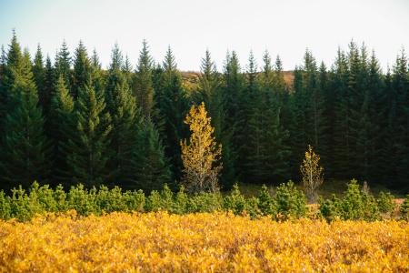
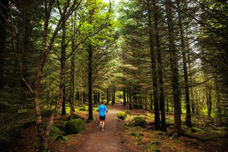
The Hjalli Circle in Heiðmörk
Walk:
7.98km
Difficulty
Level 2
The Hjalli Circle in Heiðmörk runs through diverse landscapes, including lava fields and birch…
Reykjavík
Image
Æðisíða
Walk:
3.06km
Difficulty
For Everybody
An easy and enjoyable walking path along Ægisíða that starts at the Vesturbær Swimming Pool…
Reykjavík
Image
Laugardalur
Walk:
2.92km
Difficulty
Level 1
A light and accessible walking route that starts at Laugardalslaug Swimming Pool. The path…
Reykjavík
Image
Esjan up to Steinn
Walk:
6.69km
Difficulty
Level 2
The hike up Esjan is probably the most popular hiking trail in the capital area.
Reykjavík
Image
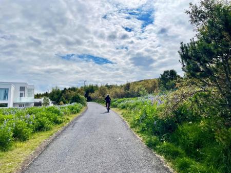
The Linda-Sala Bike Route
Bike:
9.69km
Difficulty
Level 2
A diverse 9 km cycling route through the Linda and Sala neighborhoods, within the historic…
Kópavogur
Image
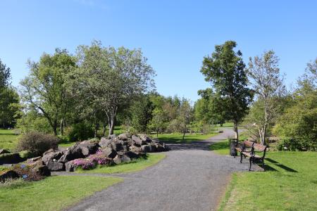
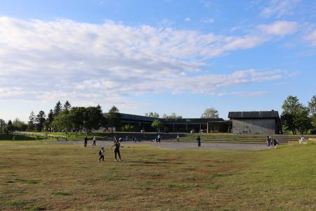
Klambratún
Outdoor Area
Klambratún is one of the larger public parks in Reykjavík and is a very popular outdoor…
Municipality
Reykjavík
Image
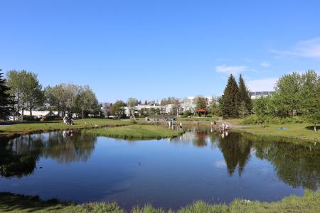
Reynisvatn
Walk:
1.49km
Difficulty
Level 1
A light and beautiful walking trail in a peaceful environment by Reynisvatn, east of…
Reykjavík
Image
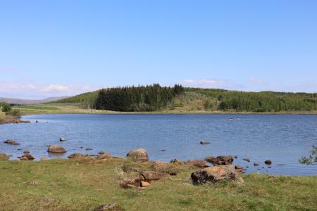
Reynisvatn
Outdoor Area
Reynisvatn is one of many small lakes found within the Greater Reykjavík Area. The surrounding…
Municipality
Reykjavík
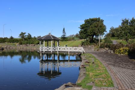
Image
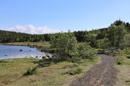
Seljatjörn
Outdoor Area
Seljatjörn is an outdoor gem in the heart of the Seljahverfi neighborhood in Breiðholt. The…
Municipality
Reykjavík
Image
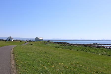
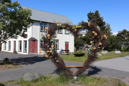
The Heart of Hafnarfjörður
Walk:
4.71km
Difficulty
For Everybody
This scenic walk through Hafnarfjörður begins along the coast and winds through the enchanting…
Hafnarfjörður
Image
Öskjuhlíð
Walk:
5.99km
Difficulty
Level 2
Öskjuhlíð is a unique recreational area near downtown Reykjavík with diverse nature and…
Reykjavík
Image
Around Helgafell in Hafnarfjörður
Walk:
8.34km
Difficulty
Level 2
The hike up Helgafell in Hafnarfjörður is very popular among locals, but walking the scenic…
Hafnarfjörður
Image
Cycling through Hafnarfjörður
Bike:
18.04km
Difficulty
Level 2
Cycling route from Ásvallalaug in Hafnarfjörður via Hvaleyrarvatn, featuring both paved and…
Hafnarfjörður
Image
Cycling in Grafarholt and Úlfarsárdalur
Bike:
8.56km
Difficulty
Level 1
A light and enjoyable cycling route from Dalslaug, passing through Grafarholt and…
Reykjavík
Image
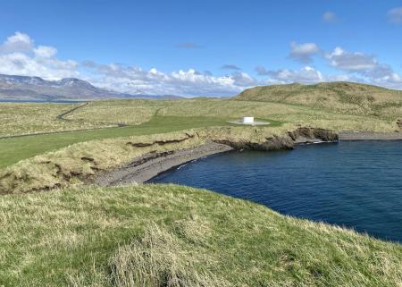
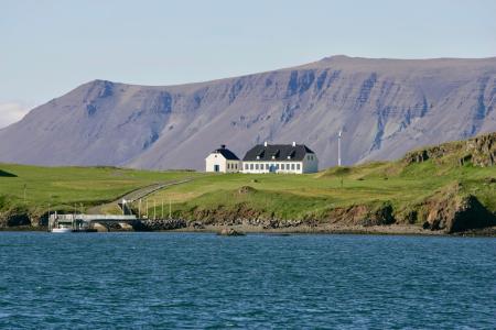
Viðey
Walk:
8.04km
Difficulty
Level 2
The walking route around Viðey is easy and enjoyable, where nature, history, and art…
Reykjavík
Image
Viðey
Outdoor Area
Viðey Island is a natural paradise that holds a special place in the hearts of Reykjavík…
Municipality
Reykjavík
Image
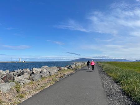
Around Reykjavik and Seltjarnarnes
Bike:
25.99km
Difficulty
Level 3
A popular and scenic cycling route around Reykjavík and Seltjarnarnes.
Reykjavík
Seltjarnarnes
Image
Kópavogsdalur and Kópavogstún
Walk:
3.27km
Difficulty
For Everybody
A short and scenic walking route through Kópavogsdalur and Kópavogstún, well suited for…
Kópavogur
Image
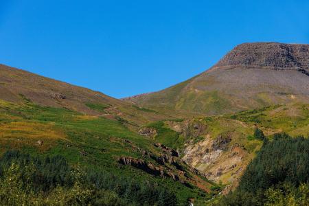
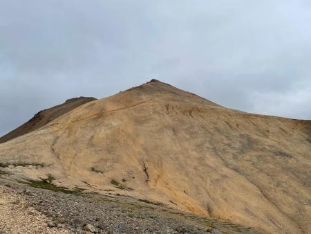
Móskarðshnjúkar
Walk:
8.03km
Difficulty
Level 3
Móskarðshnjúkar are two majestic peaks east of Esja, offering a challenging but well-marked…
Reykjavík
Image
Eldborg, Stóra Kóngsfell and Drottning
Walk:
5.31km
Difficulty
Level 2
A beautiful hiking route that begins at Eldborg in Bláfjöll. The path leads through moss…
Kópavogur
Pagination
Page
1
Page
2
Page
3
Page
4
Next page
››
Last page
Last »