Skip to main content
Út um allt ... höfuðborgarsvæðið
en
is
Enter a search string
Walk
Outdoor Area
Bike
Municipality
(-)
Reykjavík
Mosfellsbær
Kópavogur
Garðabær
Hafnarfjörður
(-)
Seltjarnarnes
Path Surface
Other
Asphalt
Gravel
Swamp
Tufts
Grass
Facet Path Surface
Duration
1 - 2 hours
30 - 60 minutes
2 - 3 hours
3 - 4 hours
30 minutes
Facet Duration
Difficulty
Level 1
Level 2
For Everybody
Level 3
Facet Difficulty
Area Access
Child-friendly area
Dogs allowed
Accessible for Disabled
Facet Area Access
Area services
Walking Paths
Benches / Resting Area
Waste Bins
Parking
Cycling Path
Tables and Benches
Artwork
Playground
Toilets
Culture / History
Drinking Water
Exercise Equipment
BBQ Area
Lighting
Restaurant / Café
Water Playground
Volleyball Court
Frisbee Golf
BBQ Shelter
EV Charging Station
Football Field
Bouncy Castle
Toddler Playground
Dog Playground
Basketball Court
Swimming Pool
Mini Golf
Park
Sea Swimming
Facet Area services
Area Type
Green Area
Sea and Shore
History and/or Culture
Lake
Forest
Facet Area Type
Home
Bike and Hiking Routes
Map of Bike and Hiking Routes
Outdoor Areas
Map of Outdoor Areas
About the Website
How do I use the Website?
Visit Reykjavík
Image
The Water Circle in Heiðmörk
Bike:
7.56km
Difficulty
Level 1
A scenic cycling route in Heiðmörk marked with blue posts, passing by lakes and educational…
Reykjavík
Image
Öskjuhlíð
Bike:
5.99km
Difficulty
Level 2
This bike trail in Öskjuhlíð offers a scenic ride through forested areas and historical…
Reykjavík
Image
Fossvogsdalur
Bike:
6.27km
Difficulty
Level 1
Biking through Fossvogsdalur offers a scenic ride along lush trails, with vibrant birdlife and…
Kópavogur
Reykjavík
Image
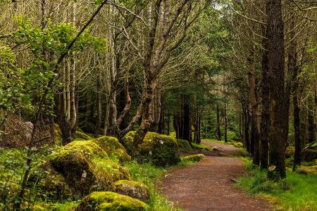
Strípur in Heiðmörk
Walk:
4.28km
Difficulty
Level 2
Strípshringur is a trail in Heiðmörk which runs through well-vegetated forested areas and open…
Reykjavík
Pagination
First page
« First
Previous page
‹‹
Page
1
Page
2
Page
3