Skip to main content
Út um allt ... höfuðborgarsvæðið
en
is
Home
Bike and Hiking Routes
Map of Bike and Hiking Routes
Outdoor Areas
Map of Outdoor Areas
Sundlaugar
Map of Swimming Pools
About the Website
How do I use the Website?
Visit Reykjavík
Always
Open all seasons
Image
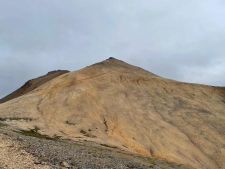
Móskarðshnjúkar
Walk:
8.03km
Difficulty
Level 3
Móskarðshnjúkar are two majestic peaks east of Esja, offering a challenging but well-marked…
Reykjavík
Image
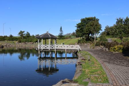
Kópavogsdalur and Kópavogstún
Walk:
3.27km
Difficulty
For Everybody
A short and scenic walking route through Kópavogsdalur and Kópavogstún, well suited for…
Kópavogur
Image
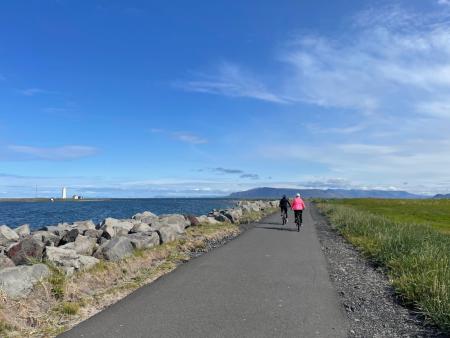
Around Reykjavik and Seltjarnarnes
Bike:
25.99km
Difficulty
Level 3
A popular and scenic cycling route around Reykjavík and Seltjarnarnes.
Reykjavík
Seltjarnarnes
Image
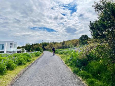
Cycling in Grafarholt and Úlfarsárdalur
Bike:
8.56km
Difficulty
Level 1
A light and enjoyable cycling route from Dalslaug, passing through Grafarholt and…
Reykjavík
Image
Cycling through Hafnarfjörður
Bike:
18.04km
Difficulty
Level 2
Cycling route from Ásvallalaug in Hafnarfjörður via Hvaleyrarvatn, featuring both paved and…
Hafnarfjörður
Image
Cycling in Mosfellsbær
Bike:
10.58km
Difficulty
Level 1
An enjoyable cycling route in Mosfellsbær that starts at the Varmár sports area and runs along…
Mosfellsbær
Image
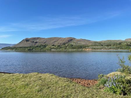
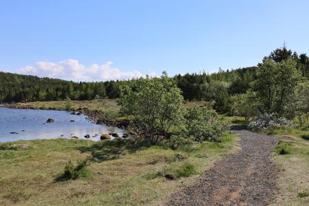
Hafravatn
Walk:
5.69km
Difficulty
Level 1
Hafravatn is a beautiful lake in Mosfellsbær. It’s enjoyable to walk around the lake and take…
Mosfellsbær
Image
Hafravatn
Outdoor Area
Hafravatn in Mosfellsbær is a peaceful and beautiful outdoor recreation area located just east…
Municipality
Mosfellsbær
Image
Reykjaborg and Lali
Walk:
6.86km
Difficulty
Level 2
The two mountains Reykjaborg and Lali are neither steep nor high, making them ideal for a…
Mosfellsbær
Image
Around Helgafell in Hafnarfjörður
Walk:
8.34km
Difficulty
Level 2
The hike up Helgafell in Hafnarfjörður is very popular among locals, but walking the scenic…
Hafnarfjörður
Image
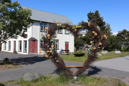
The Heart of Hafnarfjörður
Walk:
4.71km
Difficulty
For Everybody
This scenic walk through Hafnarfjörður begins along the coast and winds through the enchanting…
Hafnarfjörður
Image
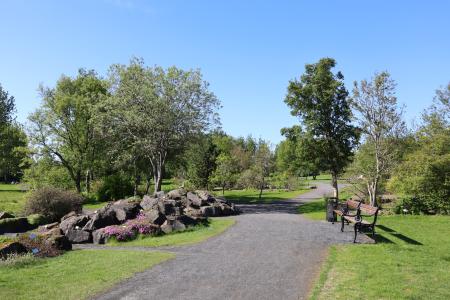
Seljatjörn
Outdoor Area
Seljatjörn is an outdoor gem in the heart of the Seljahverfi neighborhood in Breiðholt. The…
Municipality
Reykjavík
Image
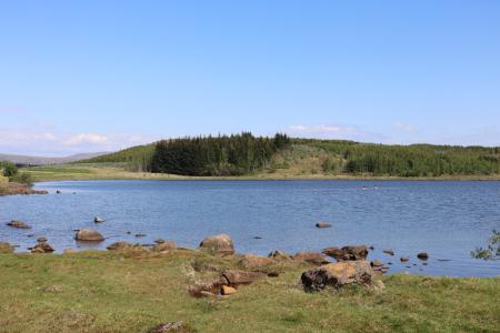
Reynisvatn
Outdoor Area
Reynisvatn is one of many small lakes found within the Greater Reykjavík Area. The surrounding…
Municipality
Reykjavík
Image
Reynisvatn
Walk:
1.49km
Difficulty
Level 1
A light and beautiful walking trail in a peaceful environment by Reynisvatn, east of…
Reykjavík
Image
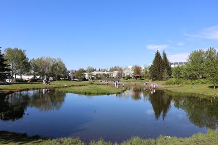
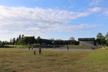
Klambratún
Outdoor Area
Klambratún is one of the larger public parks in Reykjavík and is a very popular outdoor…
Municipality
Reykjavík
Image
The Linda-Sala Bike Route
Bike:
9.69km
Difficulty
Level 2
A diverse 9 km cycling route through the Linda and Sala neighborhoods, within the historic…
Kópavogur
Image
Laugardalur
Walk:
2.92km
Difficulty
Level 1
A light and accessible walking route that starts at Laugardalslaug Swimming Pool. The path…
Reykjavík
Image
The Álftanes Circle
Bike:
12.47km
Difficulty
Level 2
A light and accessible cycling route around Álftanes, offering views of the sea, peaceful…
Garðabær
Image
Æðisíða
Walk:
3.06km
Difficulty
For Everybody
An easy and enjoyable walking path along Ægisíða that starts at the Vesturbær Swimming Pool…
Reykjavík
Image
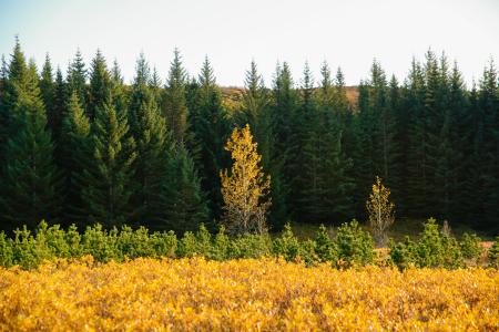
The Hjalli Circle in Heiðmörk
Walk:
7.98km
Difficulty
Level 2
The Hjalli Circle in Heiðmörk runs through diverse landscapes, including lava fields and birch…
Reykjavík
Image
Strípur in Heiðmörk
Walk:
4.28km
Difficulty
Level 2
Strípshringur is a trail in Heiðmörk which runs through well-vegetated forested areas and open…
Reykjavík
Image
The Sun Circle in Heiðmörk
Walk:
5.69km
Difficulty
Level 2
The Sun Circle is a hiking route near Vífilsstaðavatn, located in the scenic Heiðmörk area.
Garðabær
Image
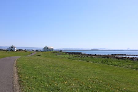
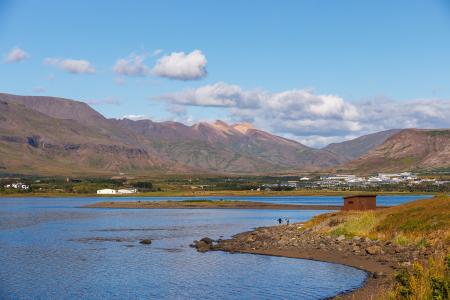
Leiruvogur
Outdoor Area
The Leiruvogur shore is a beautiful natural gem with abundant birdlife, making it a perfect…
Municipality
Mosfellsbær
Image
Fossvogsdalur
Bike:
6.27km
Difficulty
Level 1
Biking through Fossvogsdalur offers a scenic ride along lush trails, with vibrant birdlife and…
Kópavogur
Reykjavík
Pagination
First page
« First
Previous page
‹‹
Page
1
Page
2
Page
3
Page
4
Page
5
Next page
››
Last page
Last »